
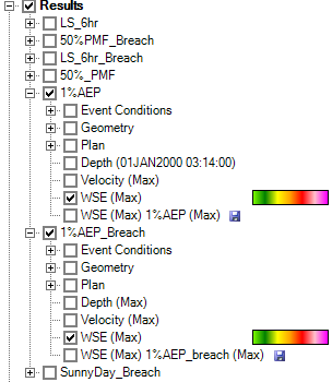
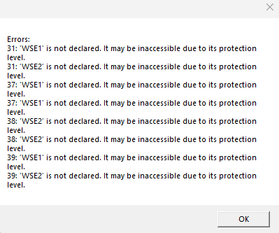
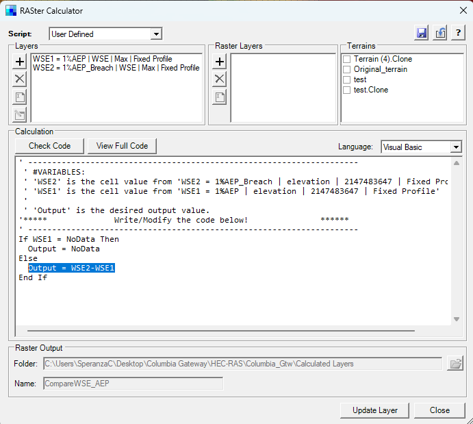
1. Check the results of the WSE (Max) you want to compare. If they are not visible, you cannot compare them with the RASter Calculator.


If you give them different names, you can
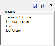
Uncheck the terrains, since you don't need them.
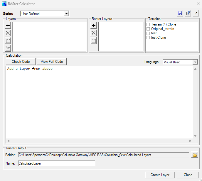
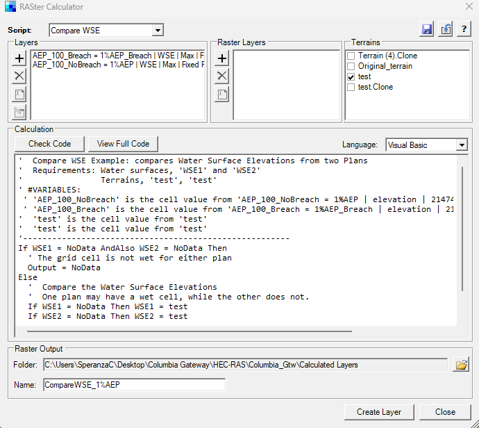
Now you have to modify the line in the script, writing the right computation that you want to do: the subtraction between the two Water Surface Elevation (Max) layers.
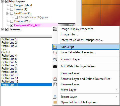
1. Right-click on the raster that you have already generated.
2. Modify that specific line on the script.
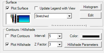
Additional steps for a better understanding of the results
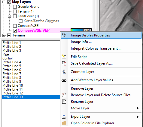
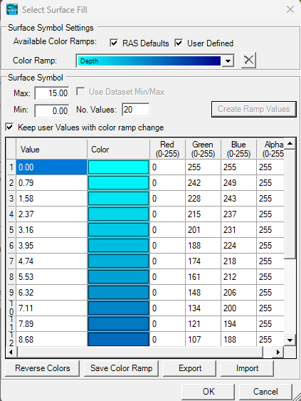
Open the Surface Symbol Settings by clicking on the image under the Plot Surface checkbox.

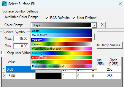
Select a more appropriate Color Ramp, like "Depth".
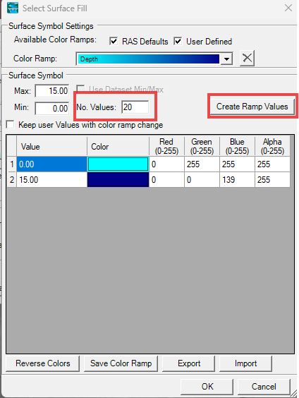
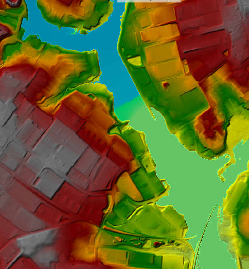
You obtain this:
If you're looking for convergence between the Breach and No-Breach scenarios, and the condition is that the difference in WSE results is less than 1 foot, then you can set the ranges in a way that visually highlights when the 1-foot threshold is reached.
In this case, you can set the first range up to a value of 0.99 feet and assign it a different color, for example green. The next range can then start from 1.
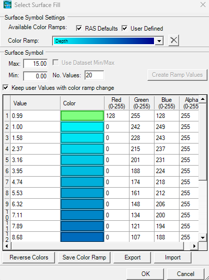
Make sure to uncheck the box "Update Legend with View".
The areas where convergence occurs between the Breach and No-Breach scenarios are now clearly visible, that is, where the difference between the WSE (Max) results is less than 1 foot.
Aggiungi commento
Commenti