This tutorial is part of the following workflow for the loss parameters computation: Loss Parameters Calculation
First you should have added on your ArcGIS Map the shapefile of the watershed.
Download the County Boundaries
- Map > Add Data
- In the Browser window, under Portal group, select ArcGIS Online.

3. On the Search bar, type [Name of the Country] + "County Boundaries". For Example: "NY County Boundaries".
4. Select the shapefile and press OK.

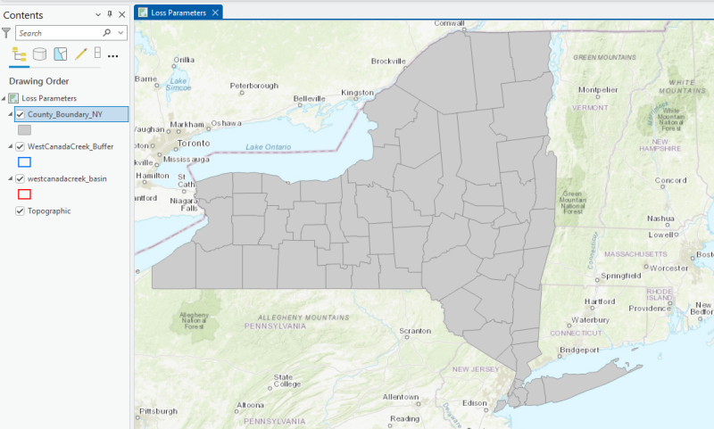
5. This is what you should obtain.
Identify Counties Within the Watershed
Now we need to identify which counties the watershed of interest extends across.
This information is important because it is required by the SSURGO Bulk Downloader tool.
Remove the fill color from the shapefiles and enable county name labels. Follow this tutorial.
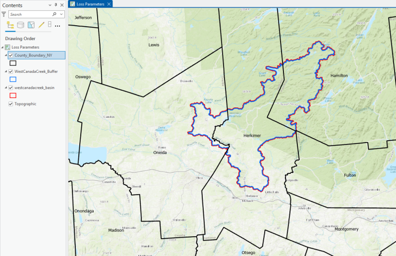
In this case, you can see that your watershed is located within the following counties:
-
Oneida
-
Herkimer
-
Hamilton
-
Fulton
Use the SSURGO Bulk Downloader tool

1. In the "Search by Areasymbol" bar, type the state's abbreviation followed by an asterisk — for example, NY*.
This will return a list of all the counties in the state of New York, as each county's area symbol is indexed starting with the state's abbreviation.
2. Next, choose from the list the counties you previously identified.
3. Running the tool can take some minutes.

Additional Steps: Import the shapefile output and then merge and clip them
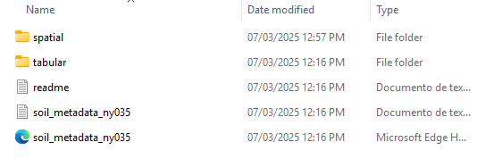
- The tool generates a separate folder for each selected county. Inside each folder, you will find the following files.
- Inside each folder, there are two subfolders: spatial and tabular. The spatial folder contains shapefiles, while the tabular folder includes additional text files with more information.

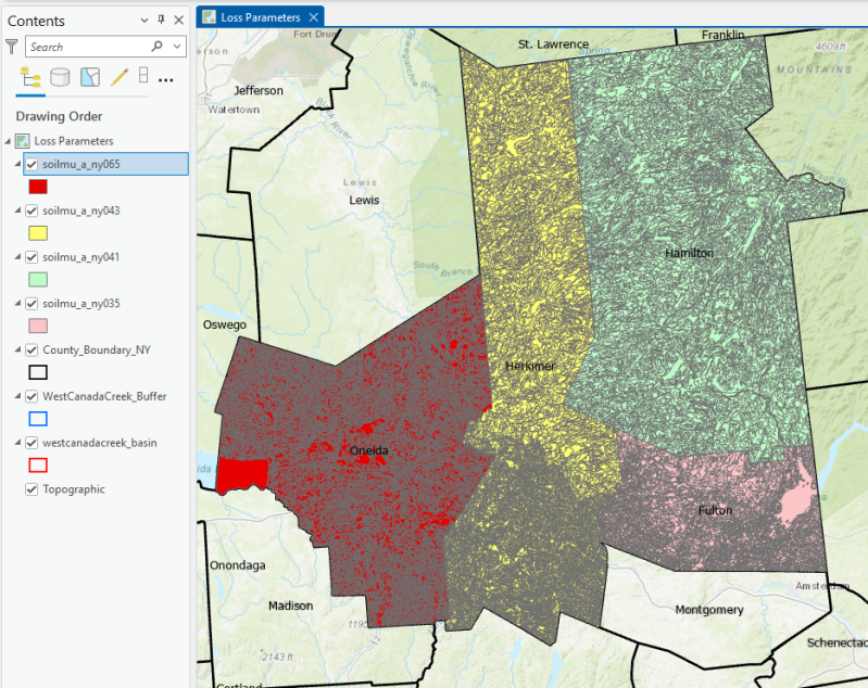
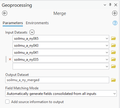
3. For each county, we load the shapefile named "soilmu_a_" followed by the state abbreviation and the county's ID number.
In this example, we have imported the following four shapefiles:
- soilmu_a_ny035
- soilmu_a_ny041
- soilmu_a_ny043
- soilmu_a_ny065
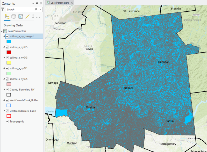
You can also see that these are the only shapefiles in the spatial folder that are larger in size than the others.

4. We use the Merge tool to combine these shapefiles into a single layer.
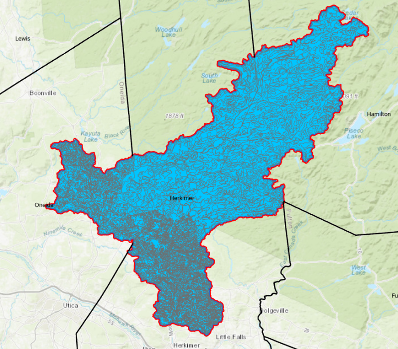
5. We use the Clip tool to trim the merged layer to the extent of the watershed buffer boundary.

Aggiungi commento
Commenti